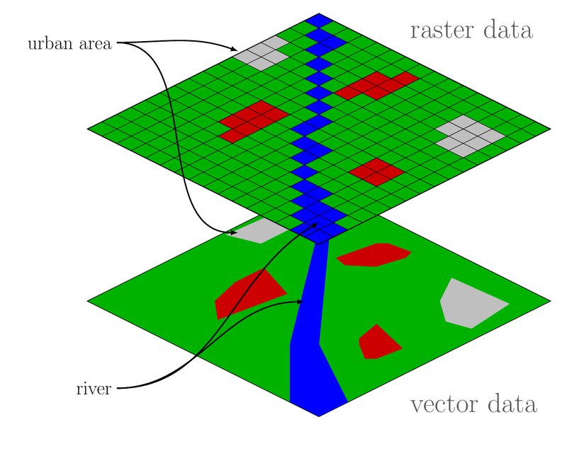
Raster data is a way of storing geographic information as a grid of cells (also called pixels) arranged in rows and columns. Each cell holds a value for a location on Earth—for example elevation, rainfall, temperature, or a land-cover category.
In GIS, raster data is often contrasted with vector data (points, lines, and polygons). Rasters work especially well for continuous surfaces such as elevation or temperature maps, and they can also store discrete categories such as land cover. Satellite and aerial imagery are common forms of raster data.
Source: U.S. Geological Survey — Geographic Information Systems (GIS) Educational Resources